Killingworth Land Conservation Trust
  • Home
  • Join Us
    • Directors
    • Conservation Easements
    • Become a Steward
    • Land Acquisition Projects
  • Donate Now
  • Events
    • Spring Program
    • Fall Program
    • Cranberry Harvest
  • Platt Nature Center
  • Our Properties & Trails
    • Cranberry Bogs
    • Hammonassett River Trail
    • Winkel Pond Trail
    • Whispering Oaks Trail
    • Trails on Google Maps
  • Plant Native
  • Contact Us
Dedicated to the preservation of open space in the town of Killingworth, Connecticut.
Picture
THE HAMMONASSET RIVER TRAIL 

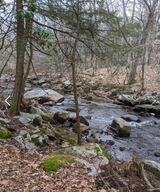
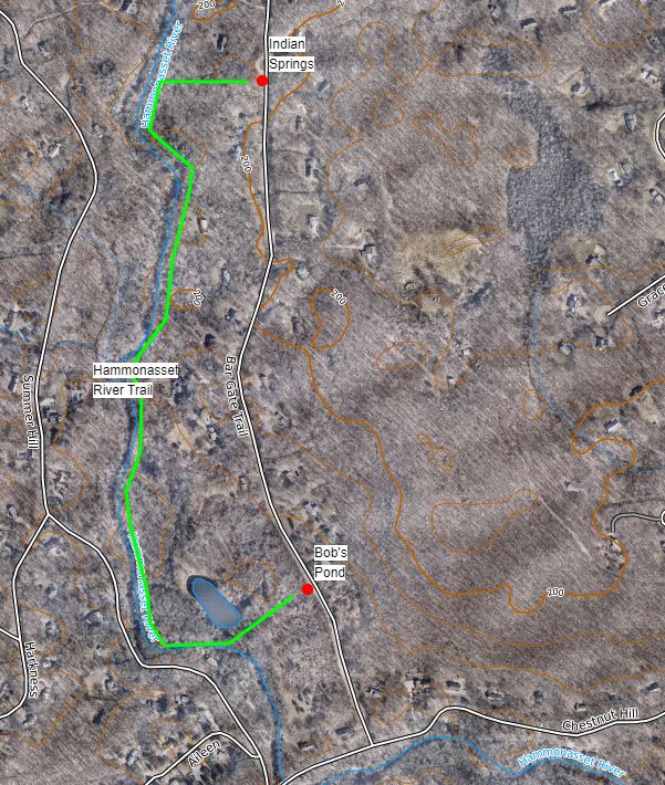
Location: The trail has two access points. The southern one is at Bob's Pond and the northern entrance is at Indian Springs. The trail used to continue north to Route 80, but at this point, that trail is to difficult to manage and contains steep terrain. On Bargate Trail, park safely on the side of the road by the trail entrance. 

Length/Difficulty: The entire walk is 0.85 miles.

Description: This trail is blazed with yellow pain. One section was originally an Eagle Scout project, but the rest was completed by the land trust trails committee in 2004-2005. The northern section was the first KLCT land purchase, the next section south was received when the Madison Hollow subdivision was built, 5 owners with deeded rights to the river’s edge have granted us pedestrian use privileges, and the southern section was received when the Indian River subdivision was built. 

​Here is a PDF map to download.


Picture
Proudly powered by Weebly
  • Home
  • Join Us
    • Directors
    • Conservation Easements
    • Become a Steward
    • Land Acquisition Projects
  • Donate Now
  • Events
    • Spring Program
    • Fall Program
    • Cranberry Harvest
  • Platt Nature Center
  • Our Properties & Trails
    • Cranberry Bogs
    • Hammonassett River Trail
    • Winkel Pond Trail
    • Whispering Oaks Trail
    • Trails on Google Maps
  • Plant Native
  • Contact Us